
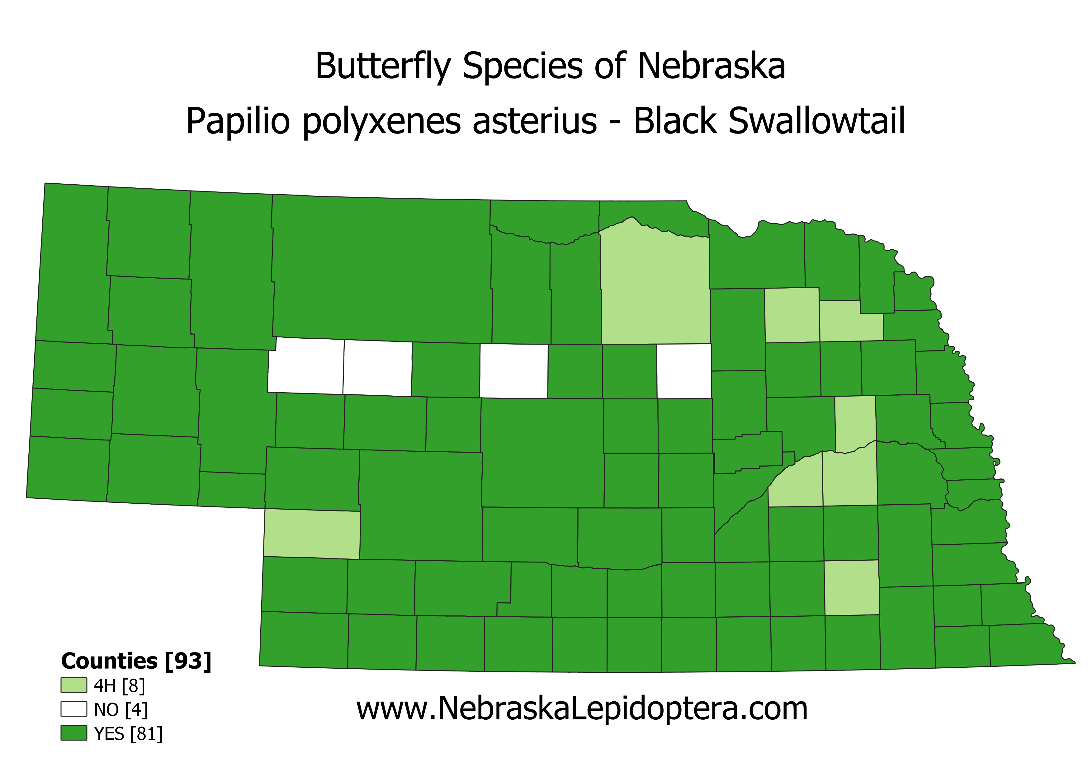
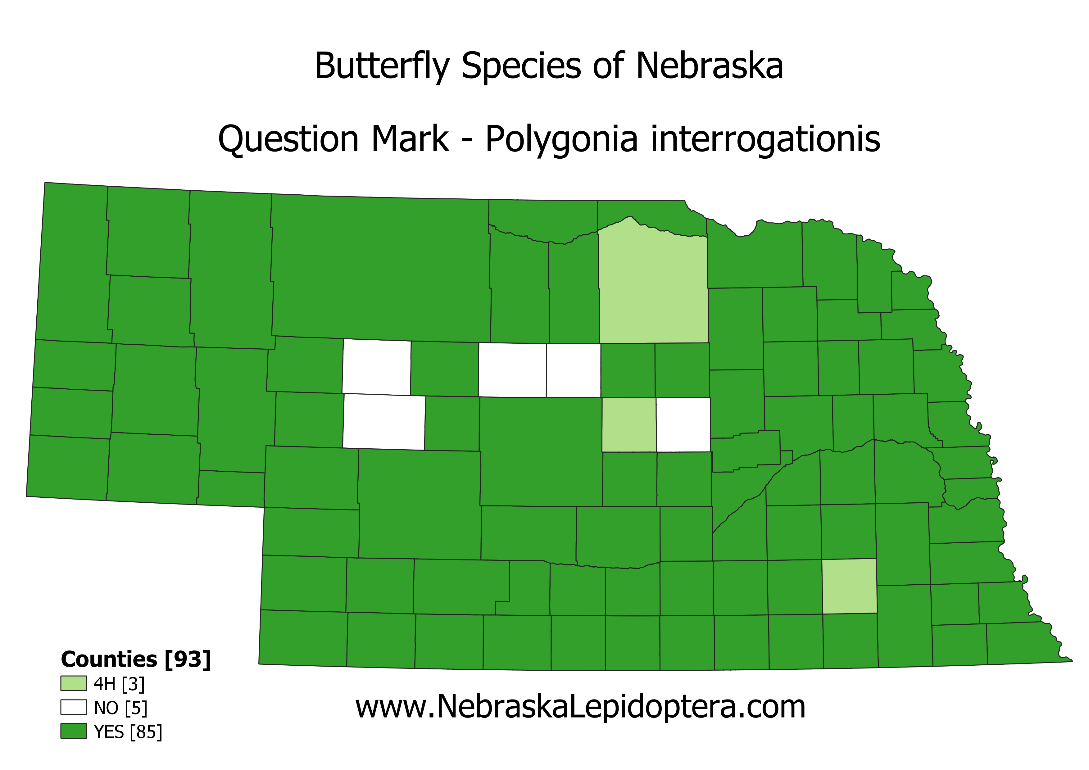
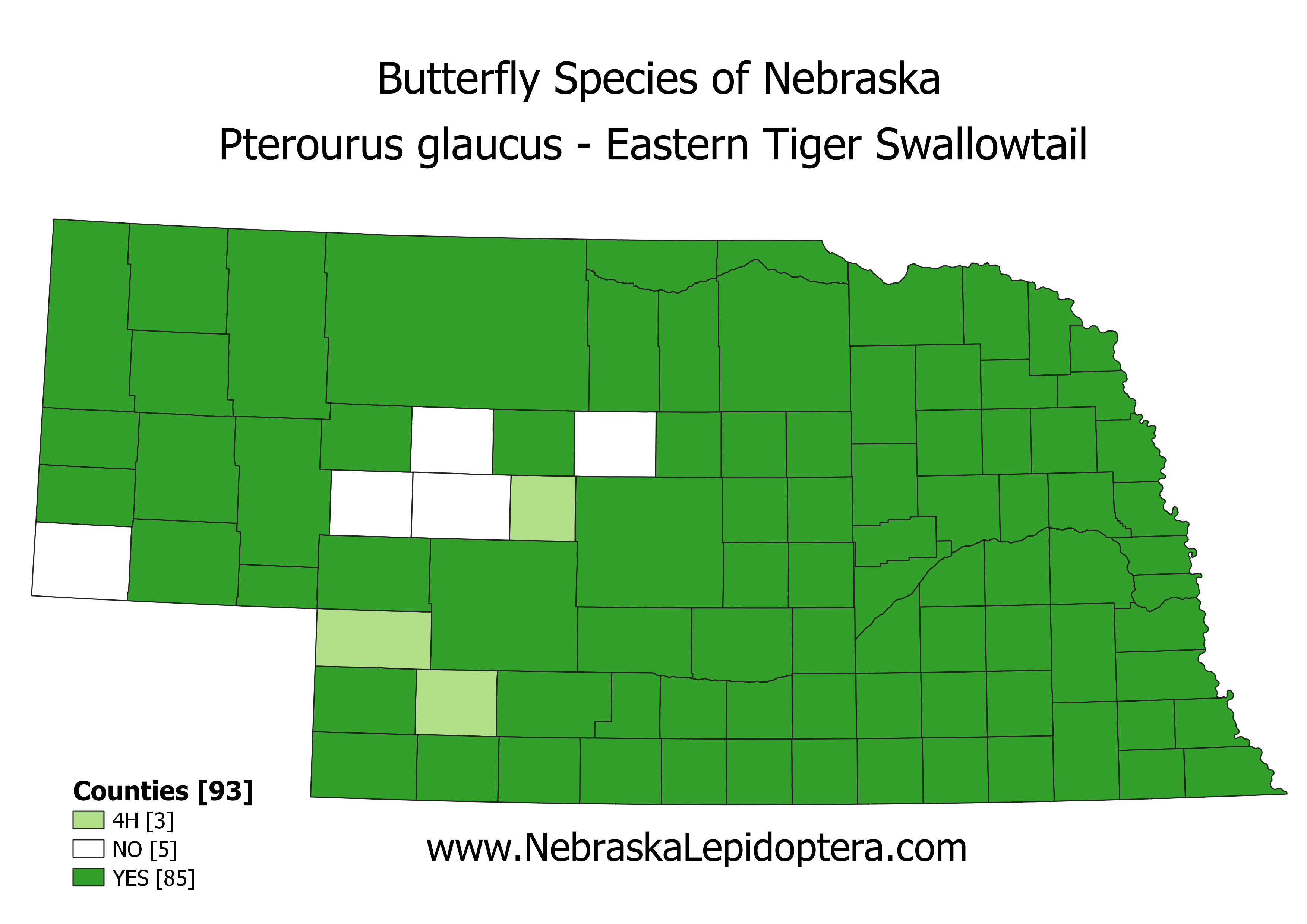
Here are the remaining seven maps for butterflies with six or fewer counties needed to complete their “clean sweep” of all 93 counties. If you happen to be traveling through or have relatives in any of these counties there is an opportunity to get your/their name in the record book (see Garfield County post from four days ago). Send a photo of your butterfly along with date and locality to nebraskabutterflies@gmail.com. Pics need not be restricted to the species listed below.


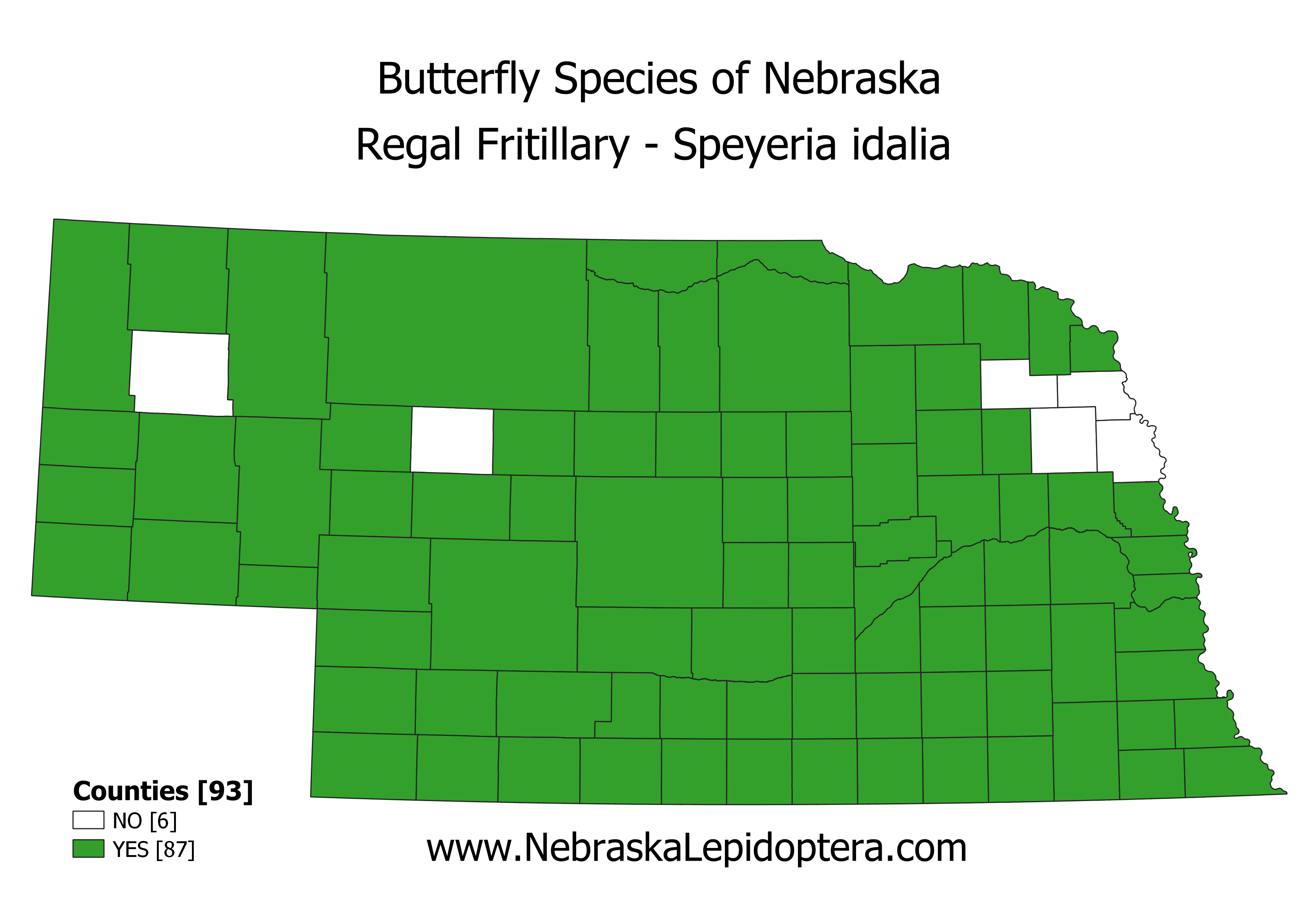

The US Fish & Wildlife Service is in the process of gathering data to study the possible listing of the Regal Fritillary as a threatened species. They have records for Burt, Cuming, Wayne and Box Butte counties that I don’t, leaving just Thurston and Hooker counties without records. They are looking for “current” records which by their definition are from the year 2000 or later. If you have records later than 2000 for any of the counties shaded in orange you can submit them to brooke_stansberry@fws.gov. If possible they would like data for the record (Latitude, Longitude, State, County, Date, and Source).